A Story Written by Floods
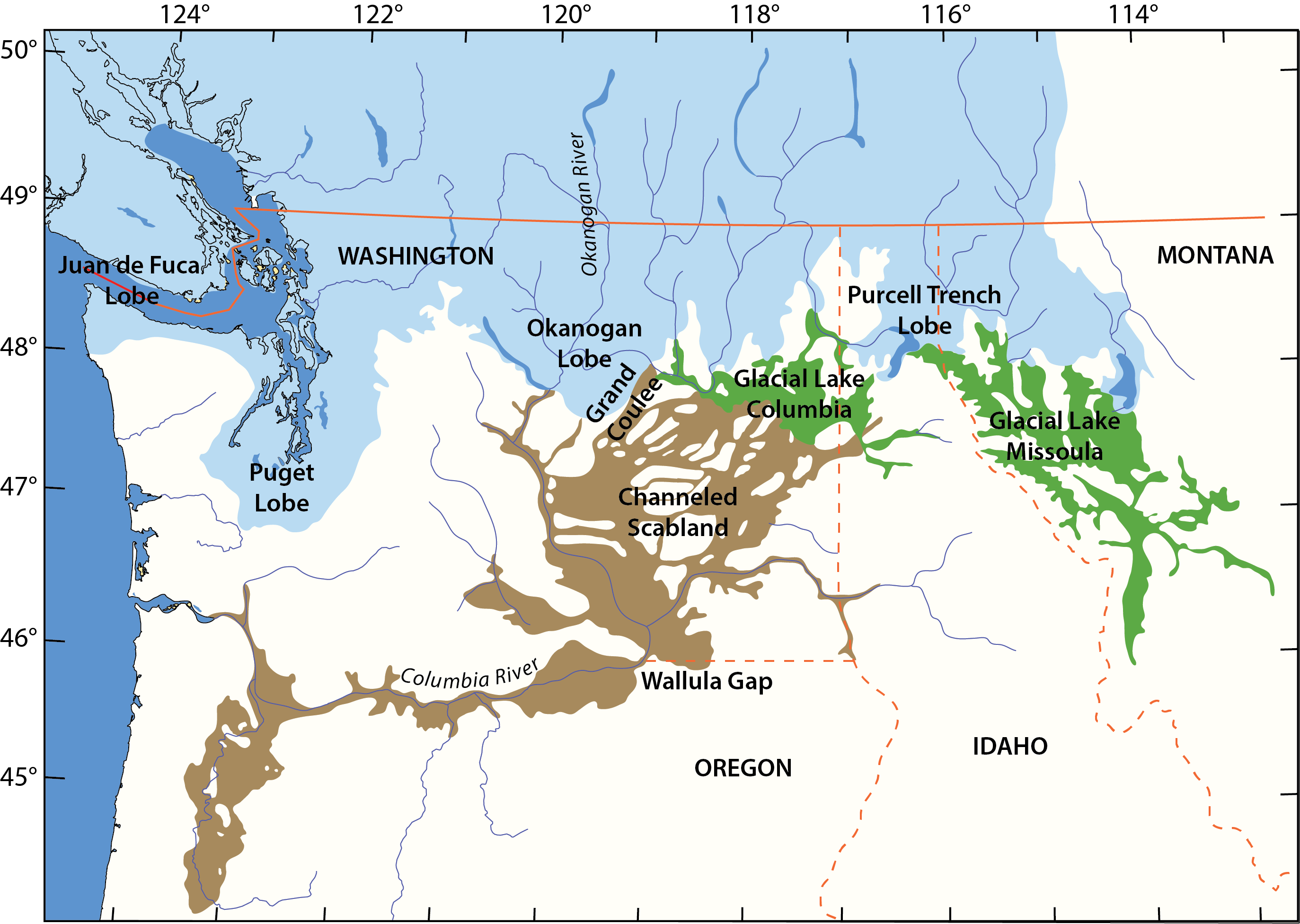
The Inland Northwest is a land written by floods. Somewhere between 15 and 30 thousand years ago, during the last Ice Age, a glacial lake half the size of Lake Michigan existed just north of present-day Missoula. This Lake Missoula was what scientists today call a proglacial lake–a body of water held together by massive ice dams. As temperatures fluctuated, however, so would the ice dams. When temperatures became warmer and the ice less thick, Lake Missoula was prone to bursting toward the east and present-day Spokane.
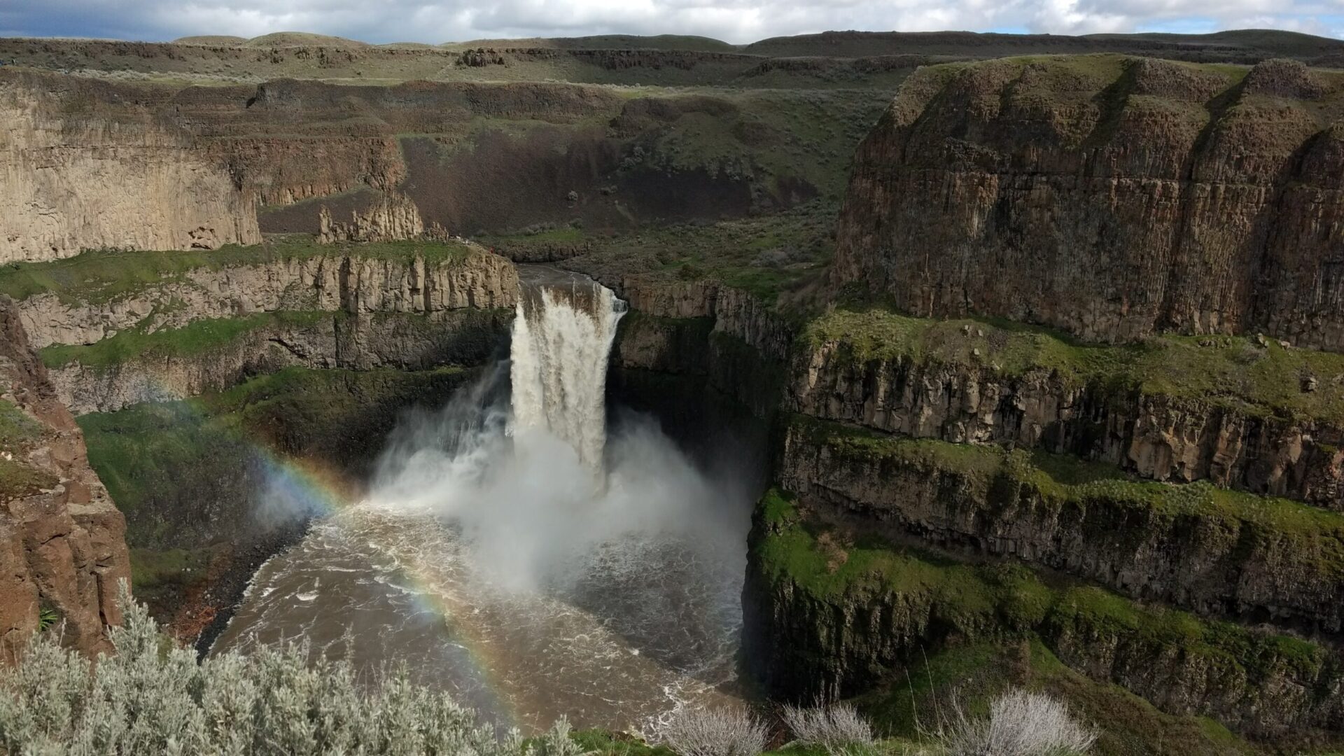
The imposing basalt canyon walls and coulees that we have all come to associate with the Inland Northwest’s striking beauty are actually scars from what are now referred to as the Missoula Floods, which swept across eastern Washington over the course of thousands of years as the ice dams burst. These floods reformed in a sporadic, cyclical fashion. Over time, the rugged scabs of the Palouse were carved out of the earth by tumultuous rushing water. Even now, you can almost imagine the shape of the currents winding through Spokane, lifting the earth in spots, and grinding it down in others, exposing the region’s basalt underbelly.
Today, while you get lost in one of Spokane’s many beautiful nature preserves, take a look around and see if you can spot any geological remnants of our glaciated history!